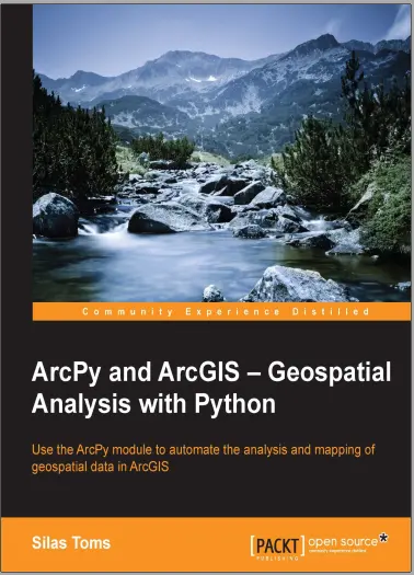
ArcPy and ArcGIS – Geospatial Analysis with Python
ArcGIS, the GIS software from industry leader ESRI, allows for the analysis and presentation of geospatial data.
The integration of Python into ArcGIS has made the ArcPy module an important tool for GIS students and professionals. The ArcPy module provides a powerful way to improve productivity when performing geospatial analysis. From basic Python scripting through advanced ArcPy methods and properties, ArcPy and other Python modules will improve the speed and repeatability of any GIS workflow.
This book will guide you from basic Python scripting to advanced scripting tools. It focuses on geospatial analysis scripting and touches on automating cartographic output. By the end of this book, you will be able to create reusable modules, add repeatable analyses as script tools in ArcToolbox, and export maps automatically. By reducing the time-consuming nature of GIS from days to hours, one GIS professional can become as powerful as a whole team.
Chapter 1, Introduction to Python for ArcGIS, offers a quick introduction to the basics of Python, including other uses for the programming language. It covers Python data types and important modules used throughout the book.
Chapter 2, Configuring the Python Environment, is an introduction to how Python works: its folder structure, executables, and modules. It also explains importing modules into scripts, the built-in modules, and covers Integrated Development Environments (IDEs), are powerful programming aids.
Chapter 3, Creating the First Python Script, demonstrates how to use ArcGIS ModelBuilder to model the first analysis and then export it as a Python script. String manipulations and how to use file paths in Python are also introduced. Preface
Chapter 4, Complex ArcPy Scripts and Generalizing Functions, examines how to perform analyses and produce outputs that are not possible using ModelBuilder. By using functions, or reusable code blocks, repeating code is avoided.
Chapter 5, ArcPy Cursors – Search, Insert, and Update, covers ArcPy data access cursors and how they are used to search, update, or insert records in feature classes and tables. It explains the quirks of iterating using cursors, and how to only select or update the records of interest.
Chapter 6, Working with ArcPy Geometry Objects, explores ArcPy Geometry objects and how they are combined with cursors to perform spatial analysis. It demonstrates how to buffer, clip, reproject, and more using the data cursors and the Arcpy geometry types without using ArcToolbox.
Chapter 7, Creating a Script Tool, explains how to make scripts into tools that appear in ArcToolbox and are dynamic in nature. It explains how the tools and scripts communicate and how to set up the ArcTool dialog to correctly pass parameters to the script.
Chapter 8, Introduction to ArcPy.Mapping explores the powerful arcpy.Mapping module and how to fix broken layer links, turn layers on and off, and dynamically adjust titles and text. It shows how to create dynamic map output based on a geospatial analysis.
Chapter 9, More ArcPy.Mapping Techniques introduce Layer objects, and their methods and properties. It demonstrates how to control map scales and extents for data frames, and covers automated map export.
Chapter 10, Advanced Geometry Object Methods, expands on the ArcPy Geometry object methods and properties. It also explains how to create a module to save code for reuse in subsequent scripts, and demonstrates how to create Excel spreadsheets containing results from a geospatial analysis.
Chapter 11, Network Analyst and Spatial Analyst with ArcPy, introduces the basics of using ArcPy for advanced geospatial analysis using ArcGIS for Desktop Network Analyst and Spatial Analyst Extensions.
Chapter 12, The End of the Beginning, covers other important topics that need to be understood to have a full grasp of ArcPy. These topics include the Environment Settings, XY values, and Z and M resolution
comments
Great
dear dir your arcgis pro can not full install why second giving error in password when unzipping
Best GIS information to used for all students!
I think the admin of this web page is actually working hard in support of his web page, because here every information is quality based material. casino en ligne France I am regular reader, how are you everybody? This paragraph posted at this web site is really fastidious. casino en ligne fiable Now I am ready to do my breakfast, when having my breakfast coming over again to read more news. casino en ligne fiable Wonderful, what a weblog it is! This website provides valuable data to us, keep it up. casino en ligne I'll immediately clutch your rss as I can't to find your email subscription link or e-newsletter service. Do you have any? Kindly permit me understand in order that I may just subscribe. Thanks. casino en ligne fiable Whats up very nice web site!! Man .. Beautiful .. Superb .. I will bookmark your website and take the feeds additionally? I am satisfied to find so many helpful info here within the submit, we need develop more techniques in this regard, thank you for sharing. . . . . . casino en ligne France This info is invaluable. When can I find out more? casino en ligne fiable Way cool! Some extremely valid points! I appreciate you writing this article and the rest of the website is also really good. casino en ligne fiable Hmm it appears like your site ate my first comment (it was super long) so I guess I'll just sum it up what I had written and say, I'm thoroughly enjoying your blog. I as well am an aspiring blog blogger but I'm still new to everything. Do you have any suggestions for newbie blog writers? I'd genuinely appreciate it. casino en ligne francais Howdy very cool web site!! Man .. Beautiful .. Wonderful .. I will bookmark your site and take the feeds additionally? I am glad to find a lot of useful information here in the put up, we need work out more strategies on this regard, thank you for sharing. . . . . . meilleur casino en ligne
Leave a Reply
Your email address will not be published. Required fields are marked *