

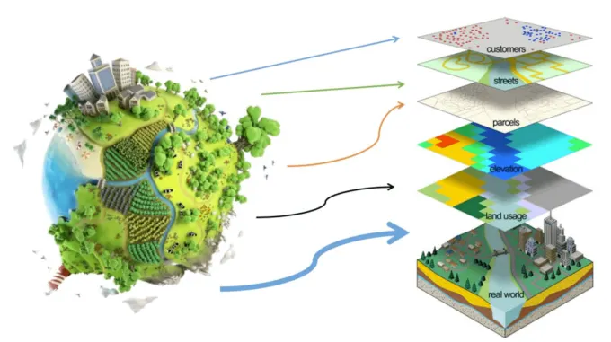
Geography is the study of the earth and its features, including landforms, oceans, and the atmosphere. For centuries, people have been studying geography to better understand the world around them. However, with the advent of Geographic Information Systems (GIS), our understanding of geography has been revolutionized. GIS technology allows us to analyze, visualize, and interpret geographic data in new and powerful ways. Here are ten ways GIS is revolutionizing the way we understand geography:
1. Spatial Analysis
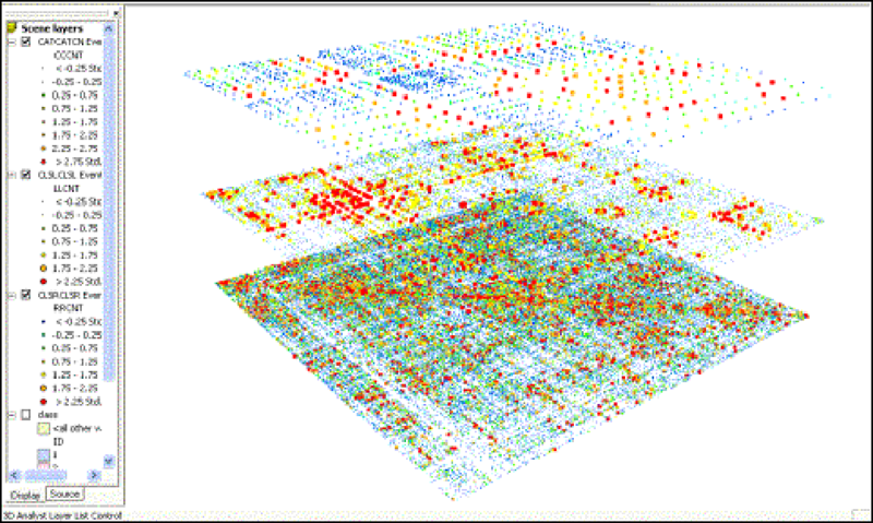
Spatial analysis is a powerful tool that allows us to understand the relationships between geographic features and phenomena. It is a process of examining the spatial distribution of data and identifying patterns, trends, and relationships that are not readily apparent through traditional data analysis methods. Spatial analysis is used in a variety of fields, including geography, ecology, urban planning, public health, and many others.
At its core, spatial analysis is about understanding how different spatial features are related to each other. For example, a spatial analysis of crime patterns might examine the relationship between crime rates and factors such as population density, socioeconomic status, or the distance to police stations. By analyzing these relationships, we can gain insights into the underlying causes of crime and develop strategies to reduce it.
One of the key benefits of spatial analysis is that it allows us to visualize data in new and powerful ways. By using mapping software or Geographic Information Systems (GIS), we can create visual representations of spatial data that reveal patterns and trends that would be difficult to detect otherwise. For example, a heat map showing the concentration of a particular pollutant in different areas of a city can help us identify areas of high pollution and plan interventions to reduce it.
There are many different techniques and tools used in spatial analysis, depending on the nature of the data and the questions being asked. Some common techniques include:
- Spatial clustering: identifying areas where similar features or phenomena are concentrated, such as clusters of high crime rates or clusters of trees in a forest.
- Spatial autocorrelation: examining the degree to which spatial features are correlated with each other, such as whether crime rates are higher in areas adjacent to high-crime areas.
- Spatial interpolation: estimating values for geographic areas where data is not available by using statistical methods to fill in the gaps.
- Spatial regression: modeling the relationships between spatial features and other variables, such as the relationship between air quality and traffic congestion.
Spatial analysis is also an important tool for environmental management. It can be used to identify areas of high biodiversity or important ecological processes, such as the migration patterns of birds or the movement of ocean currents. By understanding these patterns, we can develop strategies to protect these areas and preserve important ecological systems.
Spatial analysis is a powerful tool that allows us to understand the relationships between spatial features and phenomena. By analyzing the spatial distribution of data, we can identify patterns, trends, and relationships that are not readily apparent through traditional data analysis methods. Spatial analysis is used in a variety of fields, from urban planning to environmental management, and is an essential tool for understanding the complex relationships between people, the environment, and geography.
2. Real-Time Data Collection
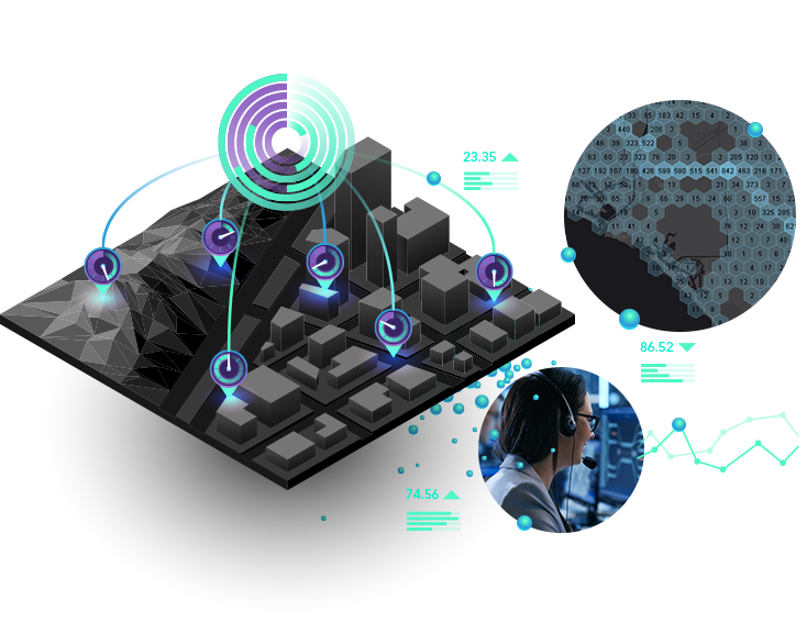
Real-time data collection is a powerful capability of Geographic Information Systems (GIS) that has revolutionized emergency response teams and urban planners' ability to make quick decisions and solve problems rapidly. With GIS, we can collect, process, and analyze data in real-time, providing critical insights and information that would be impossible to obtain through traditional data collection methods.
One of the key benefits of real-time data collection is its ability to help emergency response teams during critical situations. With real-time data, emergency teams can quickly access and analyze data to make informed decisions and coordinate their efforts. For example, during a natural disaster such as a hurricane, real-time data can help track the storm's path, assess potential damage areas, and identify critical infrastructure that needs immediate attention. By collecting and processing data in real-time, emergency response teams can save lives and prevent further damage.
Real-time data collection is also a game-changer for urban planners. With the rapid growth of cities, urban planners need to make informed decisions about transportation, land use, and infrastructure. Real-time data collection allows planners to access critical information about traffic patterns, public transportation, and other vital infrastructure in real-time, allowing them to adjust their plans quickly and effectively. For example, a real-time traffic monitoring system can provide up-to-the-minute information on traffic congestion and allow planners to adjust traffic signals and reroute traffic to minimize congestion and reduce travel times.
Real-time data collection also plays a critical role in environmental monitoring. For example, real-time sensors can provide continuous data on air and water quality, allowing for early detection of potential environmental hazards. This data can help inform policy decisions and guide interventions to mitigate environmental risks.
One of the key challenges of real-time data collection is managing the massive amounts of data that are generated. With the advent of the Internet of Things (IoT), there is an explosion of data generated by sensors and other devices. To effectively manage this data, advanced analytics tools, and machine learning algorithms are required to quickly analyze and extract insights from the data.
Real-time data collection is a game-changer for emergency response teams and urban planners. With GIS, we can collect, process, and analyze data in real-time, providing critical insights and information that would be impossible to obtain through traditional data collection methods. Real-time data allows for rapid decision-making and problem-solving, especially in dynamic environments. While managing the massive amounts of data generated by real-time data collection poses a challenge, advances in analytics and machine learning algorithms are making it increasingly feasible. Overall, real-time data collection is a critical tool for anyone who needs to make informed decisions quickly and effectively.
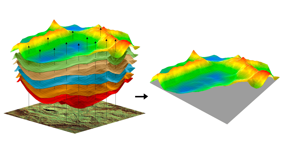
3. Data Visualization
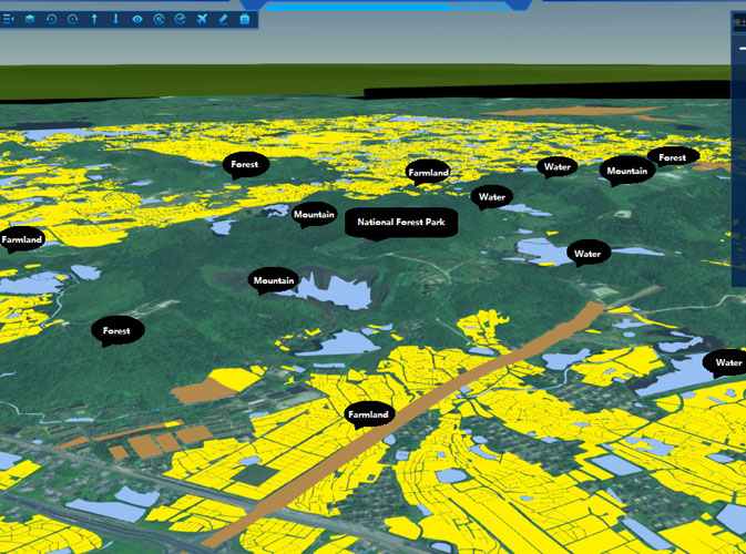
Data visualization is an essential tool for understanding and communicating geographic information. Geographic Information Systems (GIS) enable us to create maps, graphs, and charts that can be used to visualize complex data sets in a clear and accessible way. By visualizing data, we can better understand patterns, relationships, and trends, and communicate this information to a wide audience.
One of the key benefits of data visualization is its ability to simplify complex data. By visualizing data in the form of maps, graphs, and charts, we can transform large data sets into easy-to-understand visual representations. This is particularly important when dealing with geographic data, as maps can help us visualize spatial relationships and patterns that may be difficult to discern from raw data.
Data visualization can also be used to identify trends and patterns in data. For example, by creating a map of population density, we can identify areas with high concentrations of people, which may be useful for urban planners and policymakers. Similarly, a graph of temperature trends over time can help us understand patterns of climate change and inform policy decisions related to the environment.
One of the key advantages of GIS-based data visualization is its ability to integrate multiple data sets. By combining data from different sources, we can gain new insights into complex problems. For example, by combining demographic data with health data, we can identify correlations between health outcomes and socioeconomic factors, which can inform public health policy decisions.
Another benefit of GIS-based data visualization is its ability to communicate information to a wide audience. Maps, graphs, and charts are accessible to a broad range of people, from policymakers to the general public. This means that GIS-based data visualization can be used to communicate complex ideas and information in a way that is easy to understand and engage with.
One of the challenges of GIS-based data visualization is the need for high-quality data. Inaccurate or incomplete data can lead to flawed visualizations, which can result in incorrect conclusions and decisions. To ensure that data visualizations are accurate, it is essential to use reliable data sources and validate data before creating visualizations.
GIS-based data visualization is a powerful tool for understanding and communicating geographic information. By visualizing data in the form of maps, graphs, and charts, we can simplify complex data, identify trends and patterns, integrate multiple data sets, and communicate information to a wide audience. While data quality is a critical factor in GIS-based data visualization, advances in data collection and analysis are making it increasingly feasible to create accurate and informative data visualizations. As such, GIS-based data visualization will continue to play an essential role in understanding and addressing complex geographic problems in the future.
4. Spatial Modeling
Spatial modeling is an essential tool for understanding complex spatial relationships and making predictions about future events. Geographic Information Systems (GIS) provide a platform for building spatial models of real-world phenomena, such as water flow, air quality, or traffic patterns. These models can help us better understand how spatial processes work and inform decision-making in a variety of fields.
One of the key benefits of spatial modeling is its ability to simulate real-world phenomena in a controlled environment. By creating a digital model of a system, we can manipulate variables and see how they affect the system's behavior. This can help us better understand how the system works and make predictions about its future behavior.
For example, spatial models of water flow can be used to predict how floods will impact a community. By simulating different scenarios and variables, such as rainfall intensity and land use, we can estimate the potential impact of a flood on infrastructure, homes, and businesses. This information can inform emergency response plans and aid in disaster preparedness efforts.
Spatial modeling can also be used to test different scenarios and inform decision-making in urban planning. For example, a spatial model of traffic patterns can be used to test the impact of proposed transportation infrastructure projects, such as new highways or public transportation systems. This can help policymakers make informed decisions about where to allocate resources and how to best serve the needs of their community.
Another benefit of spatial modeling is its ability to integrate data from multiple sources. By combining data on a variety of spatial processes, such as population density, land use, and air quality, we can create more comprehensive models that can inform decision-making in a variety of fields.
One of the challenges of spatial modeling is the need for high-quality data. To build accurate models, it is essential to have reliable data on the variables that affect the system being modeled. Additionally, models can be complex and require significant computational power, which can be a barrier to entry for some users.
spatial modeling is an essential tool for understanding complex spatial relationships and making predictions about future events. GIS provides a platform for building spatial models that can inform decision-making in a variety of fields, from emergency response to urban planning. While there are challenges associated with spatial modeling, advances in data collection and analysis are making it increasingly feasible to build accurate and informative models. As such, spatial modeling will continue to play a critical role in understanding and addressing complex spatial problems in the future.
5. Environmental Monitoring
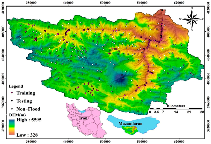
Environmental monitoring is an essential tool for understanding the health of our planet and taking action to protect it. Geographic Information Systems (GIS) provide a powerful platform for environmental monitoring, allowing us to track changes in land use, vegetation, or water quality over time. This information can help us identify environmental trends and take action to address them.
One of the key benefits of using GIS for environmental monitoring is its ability to integrate data from a variety of sources. By combining data from satellite imagery, remote sensing, and on-the-ground monitoring, we can build comprehensive models of environmental processes and changes. This can help us identify patterns and trends that may not be immediately visible through other means of monitoring.
For example, GIS can be used to monitor changes in land use and vegetation cover over time. By comparing satellite images taken at different points in time, we can see how land use has changed, where new development has occurred, and how vegetation cover has evolved. This information can help us identify areas where deforestation or land degradation is occurring, and take action to mitigate these impacts.
GIS can also be used to monitor changes in water quality over time. By tracking changes in water color or temperature, we can identify areas where pollution may be occurring and take action to address it. Additionally, GIS can be used to model the spread of pollutants in waterways, allowing us to identify areas where contamination is likely to occur and take preventative action.
Another benefit of using GIS for environmental monitoring is its ability to provide real-time data. By using sensors and other monitoring devices, we can collect data on environmental conditions in real-time and visualize it using GIS. This can be particularly useful in emergency response situations, where rapid decision-making is necessary.
While there are challenges associated with using GIS for environmental monitoring, such as data quality and processing power requirements, the benefits far outweigh the challenges. By using GIS to monitor our environment, we can better understand the complex processes that shape our planet and take action to protect it. As such, GIS will continue to play a critical role in environmental monitoring and management in the future.
6. Precision Agriculture

The agriculture industry has been revolutionized in recent years by the use of Geographic Information Systems (GIS) technology. Precision agriculture, which involves using data and technology to optimize crop yields and minimize environmental impacts, has been made possible by the use of GIS.
GIS technology is used in precision agriculture to analyze soil quality, monitor plant growth, and plan irrigation schedules. By collecting and analyzing data on soil type, moisture levels, and other factors, farmers can make more informed decisions about planting and irrigation. This helps to optimize crop yields and reduce water use, which is critical in areas where water resources are limited.
One of the key benefits of using GIS in precision agriculture is the ability to create detailed maps of farm fields. By using GPS technology and collecting data on soil type, nutrient levels, and other factors, farmers can create highly accurate maps of their fields. These maps can be used to guide planting, fertilization, and irrigation, allowing farmers to maximize yields while minimizing waste.
GIS technology can also be used to monitor plant growth and health. Sensors and other monitoring devices can be used to collect data on plant height, leaf size, and other factors. This information can be analyzed using GIS to identify areas of the field where plants are not growing as well as they should be. This can help farmers to take corrective action, such as adjusting fertilizer levels or irrigation schedules, to improve plant health and increase yields.
Another benefit of using GIS in precision agriculture is the ability to reduce pesticide use. By analyzing data on pest populations and crop growth patterns, farmers can identify areas of the field where pests are most likely to occur. This information can be used to guide targeted pesticide applications, reducing overall pesticide use and minimizing environmental impacts.
Overall, the use of GIS in precision agriculture is transforming the way that farmers manage their crops. By using data and technology to optimize crop yields and reduce environmental impacts, farmers can increase their profitability while also protecting natural resources. As such, GIS will continue to play a critical role in the future of agriculture.
7. Infrastructure Management
Geographic Information Systems (GIS) technology has become an essential tool in infrastructure management, enabling better planning, analysis, and decision-making for critical infrastructure such as roads, bridges, and pipelines. GIS technology allows for the collection and analysis of data related to infrastructure assets, making it easier to track maintenance schedules, identify potential problems, and plan for future upgrades.
Infrastructure management is a complex process that involves many stakeholders, including government agencies, private companies, and the public. Effective infrastructure management is critical to ensure public safety, economic development, and the efficient operation of transportation networks. GIS technology has become a key tool in this process, enabling better coordination, analysis, and decision-making.
One of the primary benefits of GIS in infrastructure management is the ability to collect and analyze data on infrastructure assets. This data can include information such as the location, age, and condition of infrastructure assets, as well as data on traffic flow, environmental conditions, and other factors that may impact infrastructure performance. By collecting and analyzing this data, infrastructure managers can make more informed decisions about maintenance schedules, repairs, and upgrades.
GIS technology also enables infrastructure managers to identify potential problems before they occur. By analyzing data on infrastructure assets, such as traffic patterns and weather conditions, GIS can identify areas that are likely to experience problems, such as congestion, flooding, or infrastructure failures. This information can be used to prioritize maintenance and repairs, reducing the risk of infrastructure failures and improving public safety.
Another benefit of GIS in infrastructure management is the ability to plan for future upgrades. GIS technology can be used to model different scenarios for infrastructure upgrades, such as the addition of new roads or the expansion of existing pipelines. By modeling these scenarios, infrastructure managers can determine the most cost-effective and efficient solutions for upgrading infrastructure assets.
GIS technology has become an essential tool in infrastructure management, enabling better coordination, analysis, and decision-making. By collecting and analyzing data on infrastructure assets, identifying potential problems, and planning for future upgrades, GIS can help ensure the safety and efficiency of critical infrastructure networks. As such, GIS will continue to play a critical role in the future of infrastructure management.
8. Transportation Planning
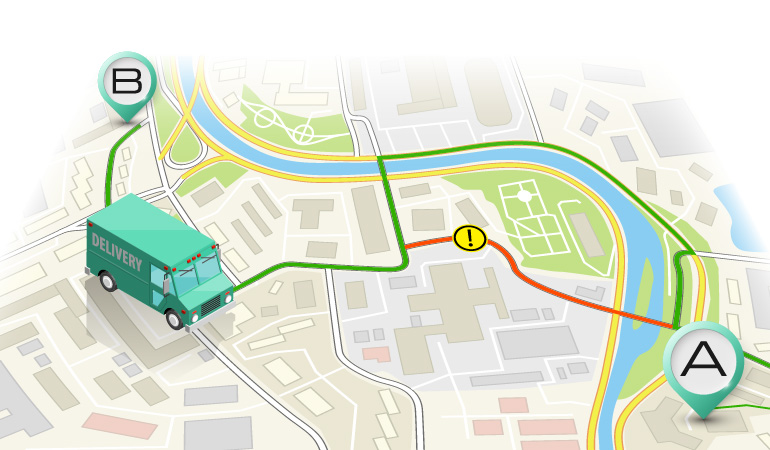
Transportation planning is a critical aspect of urban and regional development. It involves designing and managing transportation networks that are efficient, safe, and sustainable. Geographic Information Systems (GIS) technology has become a valuable tool in transportation planning, enabling better analysis, modeling, and decision-making for transportation networks.
One of the primary benefits of GIS in transportation planning is the ability to analyze and model transportation networks. GIS technology can be used to create detailed maps of transportation networks, including roads, public transportation, and airports. By analyzing this data, transportation planners can identify areas of congestion and inefficiency, and model different scenarios for improving transportation networks.
GIS technology also allows transportation planners to optimize travel times and minimize congestion. By analyzing data on traffic patterns and transportation modes, GIS can help transportation planners identify the most efficient routes and modes of transportation. This can help reduce congestion, improve travel times, and promote sustainable transportation options.
GIS technology is also essential for improving transportation safety. By analyzing data on transportation accidents and other safety-related factors, GIS can help transportation planners identify high-risk areas and implement targeted safety measures, such as improved signage or traffic signals. This can help reduce the number of accidents and improve overall transportation safety.
Another benefit of GIS in transportation planning is its ability to support public engagement and participation. GIS technology can be used to create interactive maps and other visualizations of transportation networks, making it easier for the public to understand and participate in transportation planning processes. This can help promote transparency, collaboration, and more effective transportation planning outcomes.
GIS technology has become an essential tool in transportation planning, enabling better analysis, modeling, and decision-making for transportation networks. By optimizing travel times, reducing congestion, improving safety, and promoting public engagement, GIS is helping to create more efficient, sustainable, and safe transportation networks. As such, GIS will continue to play a critical role in the future of transportation planning.
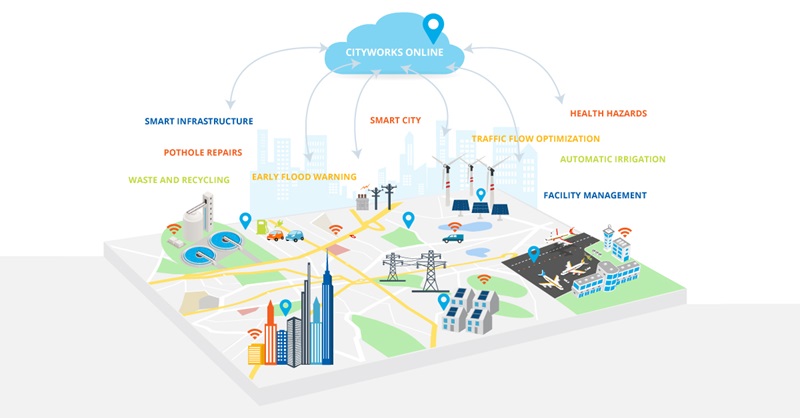
9. Urban Planning
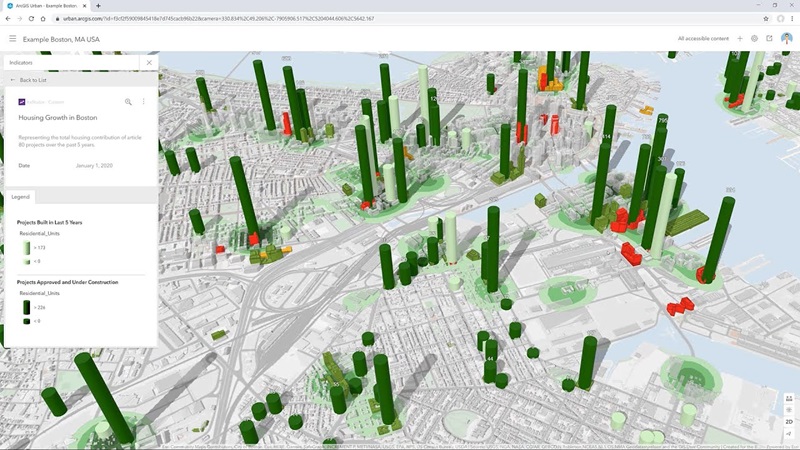
Urban planning is the process of designing and managing the physical and social aspects of cities and urban areas. It involves analyzing land use patterns, transportation networks, infrastructure, and other factors to create sustainable and livable communities. Geographic Information Systems (GIS) technology has become a critical tool for urban planners, enabling better analysis, modeling, and decision-making for urban development.
One of the primary benefits of GIS in urban planning is the ability to analyze and visualize land use patterns. GIS technology can be used to create detailed maps of urban areas, including information on population density, land use, and transportation networks. By analyzing this data, urban planners can identify areas of urbanization, patterns of growth, and areas of environmental concern.
GIS technology also allows urban planners to monitor the impact of urbanization on the environment. By analyzing data on air quality, water quality, and other environmental factors, GIS can help urban planners identify areas of concern and implement targeted strategies for mitigating environmental impacts. This can help promote sustainable urban development and protect the natural environment.
Another benefit of GIS in urban planning is its ability to support community engagement and participation. GIS technology can be used to create interactive maps and other visualizations of urban development plans, making it easier for the public to understand and participate in planning processes. This can help promote transparency, collaboration, and more effective urban planning outcomes.
GIS technology is also essential for planning new urban developments. By analyzing data on population growth, transportation networks, and land use patterns, GIS can help urban planners identify suitable locations for new developments and optimize the design of these developments. This can help create sustainable and livable communities that meet the needs of residents.
GIS technology has become an invaluable tool for urban planners, enabling better analysis, modeling, and decision-making for urban development. By analyzing land use patterns, monitoring environmental impacts, promoting community engagement, and planning new developments, GIS is helping to create sustainable and livable urban communities. As such, GIS will continue to play a critical role in the future of urban planning.
10. Natural Resource Management
Natural resource management involves the sustainable use and conservation of natural resources, including forests, water, wildlife, and fisheries. Geographic Information Systems (GIS) technology has become a critical tool for natural resource management, enabling better analysis, modeling, and decision-making for sustainable resource use.
One of the primary benefits of GIS in natural resource management is the ability to monitor the health of ecosystems. GIS technology can be used to create detailed maps of ecosystems, including information on species distribution, habitat quality, and vegetation cover. By analyzing this data, natural resource managers can identify areas of concern and implement targeted strategies for ecosystem conservation and restoration.
GIS technology also allows natural resource managers to identify areas of high biodiversity. By analyzing data on species richness, species diversity, and ecosystem complexity, GIS can help natural resource managers identify priority areas for conservation and restoration. This can help promote sustainable resource use and protect critical habitats and ecosystems.
Another benefit of GIS in natural resource management is its ability to support adaptive management strategies. By collecting and analyzing data on resource use and environmental impacts over time, GIS can help natural resource managers develop adaptive management strategies that respond to changing environmental conditions and resource use patterns. This can help ensure the sustainable use of natural resources over the long term.
GIS technology is also essential for planning sustainable resource use. By analyzing data on resource availability, demand, and use patterns, GIS can help natural resource managers develop sustainable resource management plans that balance the needs of resource users with the need to protect the natural environment. This can help promote sustainable resource use and reduce conflicts between resource users.
GIS technology has become an invaluable tool for natural resource management, enabling better analysis, modeling, and decision-making for sustainable resource use. By monitoring ecosystem health, identifying areas of high biodiversity, supporting adaptive management strategies, and planning for sustainable resource use, GIS is helping to promote the sustainable use and conservation of natural resources. As such, GIS will continue to play a critical role in the future of natural resource management.
In conclusion, GIS is a powerful tool that has revolutionized the way we understand geography. It has enabled us to analyze, visualize, and interpret geographic data in new and powerful ways, which has led to new insights and innovations in fields ranging from environmental management to precision agriculture. As GIS technology continues to evolve, we can expect it to play an even more important role in shaping our understanding of the world around us.
comments
Leave a Reply
Your email address will not be published. Required fields are marked *