Unlocking the Power of Satellite Imagery: A Comprehensive Guide to its Importance in GIS Analysis
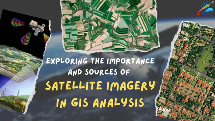
Satellite imagery is a critical component of Geographic Information Systems (GIS) because it provides a unique view of the Earth's surface from above. GIS is a system that combines geographic data, such as satellite imagery, with other types of data to analyze and model geographic phenomena.
The importance of satellite imagery in GIS field can be summarized as follows:
1. Accurate spatial data: Satellite imagery provides highly accurate spatial data, allowing GIS professionals to map and analyze features on the Earth's surface with a high level of precision.
2. Large area coverage: Satellite imagery can cover vast areas of the Earth's surface, providing a wide range of data that can be analyzed and modeled in GIS.
3. Timely and up-to-date information: Satellite imagery is regularly updated, providing current information that can be used for real-time analysis, disaster management, and emergency response.
4. Cost-effective: Satellite imagery is a cost-effective way to collect spatial data, especially for remote and hard-to-reach areas.
5. Multi-spectral data: Satellite imagery provides multi-spectral data, which means it can capture different wavelengths of light, such as visible, infrared, and thermal. This allows GIS professionals to analyze different aspects of the Earth's surface, such as vegetation cover, land use, and temperature.
Overall, satellite imagery is a critical component of GIS because it provides accurate, up-to-date, and cost-effective spatial data that can be used to analyze and model geographic phenomena.
Discovering Free Sources of Satellite Imagery for Effective GIS Analysis
There are several sources where you can get free satellite imagery for GIS analysis. Here are some options:
1. USGS EarthExplorer: The USGS EarthExplorer is a free source for satellite imagery from various sensors, including Landsat, Sentinel, and MODIS. You can search and download satellite imagery data based on your area of interest and date range.
2. Copernicus Open Access Hub: The Copernicus Open Access Hub provides free access to satellite data from the European Space Agency's Sentinel missions, including Sentinel-1, Sentinel-2, and Sentinel-3.
3. NASA Earthdata Search: NASA Earthdata Search provides free access to satellite data from NASA's Earth Observing System Data and Information System (EOSDIS). You can search and download satellite imagery data based on your area of interest and date range.
4. Google Earth Engine: Google Earth Engine is a cloud-based platform that provides access to various satellite imagery datasets, including Landsat, Sentinel, and MODIS. You can analyze and visualize satellite imagery data on Google Earth Engine's platform.
5. OpenAerialMap: OpenAerialMap is a free source for high-resolution aerial imagery from various sources, including satellite sensors. You can search and download satellite imagery data based on your area of interest and date range.
6. Sentinel Hub: Sentinel Hub provides free access to satellite imagery from the European Space Agency's Sentinel missions, as well as data from other sources. You can use the Sentinel Hub's web-based interface to browse and analyze satellite imagery data.
7. NOAA's National Centers for Environmental Information (NCEI): NCEI provides free access to satellite data from various sensors, including AVHRR, GOES, and SEVIRI. You can search and download satellite imagery data based on your area of interest and date range.
8. LandViewer: LandViewer is a free web-based platform that provides access to various satellite imagery datasets, including Landsat, Sentinel, and MODIS. You can search, analyze, and visualize satellite imagery data on LandViewer's platform.
9. Global Forest Watch: Global Forest Watch provides free access to satellite data for monitoring and analyzing global forests. You can view and download satellite imagery data of forest cover, forest loss, and forest fires.
10. MODIS Rapid Response: MODIS Rapid Response is a free source for satellite imagery data from the Moderate Resolution Imaging Spectroradiometer (MODIS). You can download satellite imagery data of various Earth surface features, including vegetation cover, land use, and temperature.
These are just a few examples of sources where you can get free satellite imagery for GIS analysis. It's important to note that the availability and quality of satellite imagery data may vary depending on the location and the type of data you need, so it's recommended to check multiple sources to find the best data for your GIS analysis.
Top Satellites Used in GIS Analysis: A Comprehensive Guide
Several satellites are commonly used in GIS analysis, depending on the type of data required and the area of interest. Here are a few examples of satellites that are widely used in GIS analysis:
1. Landsat: Landsat is a series of Earth observation satellites jointly managed by NASA and the United States Geological Survey (USGS). Landsat satellites provide multispectral imagery with a spatial resolution of 30 meters, making it useful for monitoring land use, vegetation cover, and natural resources.
2. Sentinel-2: Sentinel-2 is a satellite mission of the European Space Agency's Copernicus program. Sentinel-2 provides multispectral imagery with a spatial resolution of 10 to 20 meters, making it useful for monitoring land use, vegetation cover, and natural resources.
3. MODIS: The Moderate Resolution Imaging Spectroradiometer (MODIS) is an instrument on two NASA Earth observation satellites, Terra and Aqua. MODIS provides multispectral imagery with a spatial resolution of 250 to 1000 meters, making it useful for monitoring global vegetation cover, land use, and natural disasters.
4. GOES: The Geostationary Operational Environmental Satellite (GOES) is a series of weather satellites operated by the National Oceanic and Atmospheric Administration (NOAA). GOES provides continuous monitoring of the Earth's atmosphere, weather, and natural disasters, making it useful for real-time analysis and forecasting.
5. SPOT: SPOT (Satellite Pour l'Observation de la Terre) is a series of high-resolution Earth observation satellites operated by the French Space Agency. SPOT provides multispectral imagery with a spatial resolution of up to 1.5 meters, making it useful for detailed mapping and monitoring of urban areas, vegetation cover, and natural resources.
While these are some of the commonly used satellites in GIS analysis, there are many other satellites and sensor systems that can provide valuable data for GIS applications. The choice of satellite or sensor system depends on the specific needs and objectives of the analysis.
Summary
Satellite imagery is an essential component of GIS analysis, providing valuable data for monitoring and analyzing various features on Earth's surface, including land use, vegetation cover, natural resources, and weather patterns. There are several sources where you can access free satellite imagery for GIS analysis, such as USGS EarthExplorer, Copernicus Open Access Hub, NASA Earthdata Search, and Google Earth Engine, among others. The choice of satellite or sensor system depends on the specific needs and objectives of the analysis, and commonly used satellites include Landsat, Sentinel-2, MODIS, GOES, and SPOT. When using satellite imagery data for GIS analysis, it's important to review the data carefully and ensure that it meets the required specifications for the analysis.


comments
Leave a Reply
Your email address will not be published. Required fields are marked *