The intersection of Information Technology (IT) and Geographic Information Systems (GIS) has transformed the way we collect, analyze, and visualize spatial data.With the increasing demand for advanced geospatial technologies, it is essential to explore the key topics in this field. In this article, we discuss 100 key topics for a workshop that explores the intersection of IT and GIS.
1.Introduction to GIS: Understanding the basics of GIS, including its components, functions, and applications.
2.GIS data collection techniques: Learning about different techniques for collecting GIS data, such as GPS, aerial photography, and remote sensing.
3.GIS data analysis and visualization: Learning how to analyze and visualize GIS data using tools like ArcGIS, QGIS, and Google Earth.
4.GIS database management: Understanding how to manage and organize GIS data in databases, such as MySQL, PostGIS, and Oracle.
5.GIS web mapping: Learning how to create interactive web maps using platforms like Leaflet, OpenLayers, and Mapbox.
6.GIS programming: Learning how to program GIS applications using languages such as Python, R, and JavaScript.
7.IT infrastructure for GIS: Understanding the IT infrastructure required to support a GIS, including hardware, software, and networking.
8.GIS in urban planning: Understanding how GIS can be used in urban planning, such as zoning, land use, and transportation planning.
9.GIS in natural resource management: Understanding how GIS can be used in natural resource management, such as forestry, agriculture, and water resources.
10.GIS in emergency management: Understanding how GIS can be used in emergency management, such as disaster response and recovery planning.
11.Spatial Analysis Techniques: Introducing advanced spatial analysis techniques, including spatial statistics, network analysis, and 3D analysis.
12.Big Data in GIS: Understanding how big data can be integrated into GIS workflows and how GIS can be used for big data analysis.
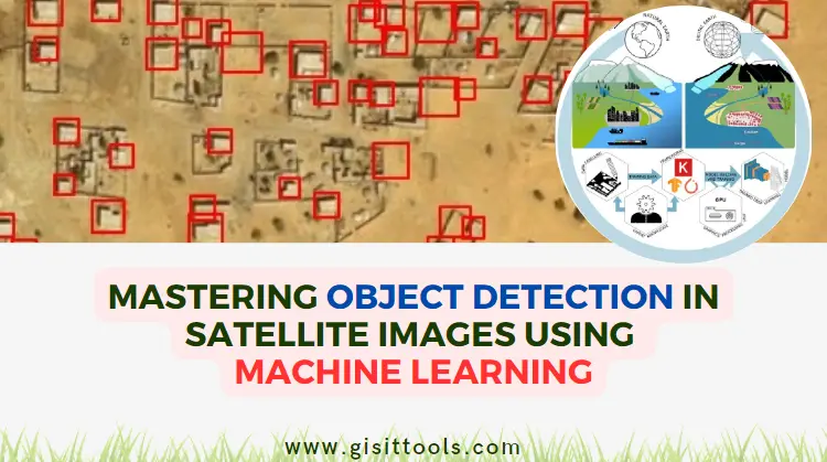
13.Machine Learning for GIS: Learning how machine learning algorithms can be applied to GIS data, including classification, clustering, and prediction.
14.Open Source GIS: Understanding the benefits and challenges of using open-source GIS software, such as QGIS, GRASS GIS, and GeoServer.
15.Mobile GIS: Understanding how GIS can be used in mobile applications, such as field data collection, navigation, and location-based services.
16.LiDAR and Photogrammetry: Learning how LiDAR and photogrammetry technologies can be used to capture high-resolution GIS data.
17.GIS and IoT: Understanding how GIS can be integrated with IoT technologies to collect and analyze spatial data in real-time.
18.Cloud GIS: Understanding how cloud-based GIS platforms, such as ArcGIS Online, Amazon Web Services, and Google Cloud Platform, can be used to store, manage, and share GIS data.
19.Spatial Data Science: Introducing the interdisciplinary field of spatial data science, which combines GIS, statistics, computer science, and data visualization.
20.GIS in Business: Understanding how GIS can be used in business applications, such as market analysis, supply chain management, and asset tracking.
21.GIS and Sustainability: Understanding how GIS can be used to support sustainable development, including green infrastructure planning, carbon footprint analysis, and environmental impact assessment.
22.Open Data and GIS: Learning how open data can be used in GIS workflows, including data acquisition, integration, and sharing.
23.GIS and Social Justice: Understanding how GIS can be used to support social justice initiatives, including redistricting, community mapping, and environmental justice analysis.
24.GIS and Public Health: Learning how GIS can be used in public health applications, including disease surveillance, epidemiology, and health services planning.
25.GIS and Transportation: Understanding how GIS can be used in transportation planning and management, including traffic flow analysis, route optimization, and public transit planning.
26.GIS and Agriculture: Learning how GIS can be used in agricultural applications, including precision farming, crop yield analysis, and soil mapping.
27.GIS and Climate Change: Understanding how GIS can be used to support climate change research and adaptation planning, including sea level rise mapping, habitat suitability analysis, and vulnerability assessment.
28.GIS and Cultural Heritage: Learning how GIS can be used in cultural heritage applications, including archaeological site mapping, heritage tourism planning, and historical reconstruction.
29.GIS and Energy: Understanding how GIS can be used in energy applications, including renewable energy site selection, energy demand forecasting, and transmission line routing.
30.GIS and Disaster Management: Learning how GIS can be used in disaster management applications, including risk assessment, emergency response planning, and damage assessment.
31.GIS and BIM Integration: Understanding how GIS and building information modeling (BIM) can be integrated to support facilities management, urban planning, and infrastructure management.
32.GIS and Crime Analysis: Learning how GIS can be used in crime analysis applications, including hotspot analysis, crime mapping, and predictive policing.
33.GIS and Natural Hazards: Understanding how GIS can be used in natural hazard applications, including flood mapping, landslide analysis, and seismic hazard assessment.
34.GIS and Water Management: Learning how GIS can be used in water management applications, including water quality monitoring, floodplain management, and watershed management.
35.GIS and Remote Sensing: Understanding how GIS and remote sensing technologies can be integrated to support land use mapping, vegetation analysis, and land cover change detection.
36.GIS and Tourism: Learning how GIS can be used in tourism applications, including destination mapping, visitor tracking, and tourism impact assessment.
37.GIS and Surveying: Understanding how GIS can be used in surveying applications, including cadastral mapping, geodetic surveying, and hydrographic surveying.
38.GIS and Education: Learning how GIS can be used in education applications, including geography education, spatial thinking, and STEM education.
39.GIS and Law Enforcement: Understanding how GIS can be used in law enforcement applications, including emergency response, crime scene mapping, and intelligence analysis.
40.GIS and Environmental Monitoring: Learning how GIS can be used in environmental monitoring applications, including air quality monitoring, wildlife habitat monitoring, and ecosystem management.
41.GIS and Infrastructure Asset Management: Understanding how GIS can be used to support infrastructure asset management, including asset inventory, condition assessment, and maintenance planning.
42.GIS and Real Estate: Learning how GIS can be used in real estate applications, including property valuation, site selection, and market analysis.
43.GIS and Supply Chain Management: Understanding how GIS can be used in supply chain management applications, including logistics optimization, inventory management, and supply chain visualization.
44.GIS and Urban Planning: Learning how GIS can be used in urban planning applications, including land use planning, zoning analysis, and transportation planning.
45.GIS and Aviation: Understanding how GIS can be used in aviation applications, including air traffic management, airport planning, and airspace analysis.
46.GIS and Natural Resource Management: Learning how GIS can be used in natural resource management applications, including forestry management, wildlife conservation, and fisheries management.
47.GIS and Land Administration: Understanding how GIS can be used in land administration applications, including land tenure mapping, land registration, and land use planning.
48.GIS and Emergency Management: Learning how GIS can be used in emergency management applications, including hazard mitigation planning, disaster response, and recovery planning.
49.GIS and Retail: Understanding how GIS can be used in retail applications, including location analysis, customer segmentation, and trade area analysis.
50.GIS and Archaeology: Learning how GIS can be used in archaeological applications, including site mapping, artifact analysis, and cultural heritage preservation.
51.GIS and Marketing: Understanding how GIS can be used in marketing applications, including location-based advertising, customer profiling, and market analysis.
52.GIS and Asset Tracking: Learning how GIS can be used in asset tracking applications, including vehicle tracking, equipment tracking, and supply chain tracking.
53.GIS and Land Use Change Detection: Understanding how GIS can be used to detect land use change over time, including urban expansion, deforestation, and land degradation.
54.GIS and Water Quality Management: Learning how GIS can be used in water quality management applications, including pollution monitoring, source water protection, and watershed modeling.
55.GIS and Public Safety: Understanding how GIS can be used in public safety applications, including emergency response, crime prevention, and fire protection.
56.GIS and Humanitarian Aid: Learning how GIS can be used in humanitarian aid applications, including disaster response, refugee camp management, and crisis mapping.
57.GIS and Environmental Planning: Understanding how GIS can be used in environmental planning applications, including ecosystem restoration, green infrastructure planning, and habitat conservation.
58.GIS and Asset Management for Utilities: Learning how GIS can be used in asset management for utilities applications, including pipeline mapping, cable management, and energy grid management.
59.GIS and Asset Management for Transportation: Understanding how GIS can be used in asset management for transportation applications, including road network mapping, bridge management, and transit system management.
60.GIS and Renewable Energy Planning: Learning how GIS can be used in renewable energy planning applications, including solar panel placement, wind turbine placement, and energy storage planning.
61.GIS and Agriculture: Understanding how GIS can be used in agriculture applications, including crop yield analysis, soil analysis, and precision farming.
62.GIS and Health: Learning how GIS can be used in health applications, including disease mapping, epidemiological analysis, and public health surveillance.
63.GIS and Climate Change: Understanding how GIS can be used in climate change applications, including climate modeling, carbon sequestration, and climate adaptation planning.
64.GIS and Renewable Energy Management: Learning how GIS can be used in renewable energy management applications, including energy production monitoring, energy demand forecasting, and renewable energy infrastructure planning.
65.GIS and Transportation Planning: Understanding how GIS can be used in transportation planning applications, including route optimization, traffic modeling, and transit planning.
66.GIS and Historical Mapping: Learning how GIS can be used in historical mapping applications, including digitization of historical maps, georeferencing, and historical landscape analysis.
67.GIS and Location-Based Services: Understanding how GIS can be used in location-based services applications, including geofencing, location-based advertising, and location-based notifications.
68.GIS and Smart Cities: Learning how GIS can be used in smart cities applications, including urban planning, infrastructure management, and public services.
69.GIS and Water Resources Planning: Understanding how GIS can be used in water resources planning applications, including water availability modeling, water allocation planning, and groundwater management.
70.GIS and Disaster Risk Reduction: Learning how GIS can be used in disaster risk reduction applications, including hazard mapping, vulnerability assessment, and disaster risk management planning.
71.GIS and Public Transportation: Understanding how GIS can be used in public transportation applications, including route planning, passenger tracking, and fleet management.
72.GIS and Tourism: Learning how GIS can be used in tourism applications, including site selection, tourism marketing, and tourism impact analysis.
73.GIS and Crime Analysis: Understanding how GIS can be used in crime analysis applications, including crime mapping, hotspot analysis, and predictive policing.
74.GIS and Biodiversity Conservation: Learning how GIS can be used in biodiversity conservation applications, including habitat mapping, biodiversity monitoring, and protected area management.
75.GIS and Energy Efficiency: Understanding how GIS can be used in energy efficiency applications, including building energy audits, energy consumption monitoring, and renewable energy integration.
76.GIS and Remote Sensing: Learning how GIS can be used in remote sensing applications, including image processing, classification, and change detection.
77.GIS and Disaster Response: Understanding how GIS can be used in disaster response applications, including search and rescue operations, damage assessment, and relief distribution.
78.GIS and Transportation Safety: Learning how GIS can be used in transportation safety applications, including accident analysis, traffic flow modeling, and road safety planning.
79.GIS and Forensic Science: Understanding how GIS can be used in forensic science applications, including crime scene mapping, crime reconstruction, and forensic evidence analysis.
80.GIS and Marine Spatial Planning: Learning how GIS can be used in marine spatial planning applications, including marine habitat mapping, coastal zone management, and marine protected area planning.
81.GIS and Real Estate: Understanding how GIS can be used in real estate applications, including property valuation, site selection, and real estate development.
82.GIS and Supply Chain Management: Learning how GIS can be used in supply chain management applications, including inventory management, logistics planning, and supplier mapping.
83.GIS and Urban Design: Understanding how GIS can be used in urban design applications, including land use planning, urban renewal, and public space design.
84.GIS and Wildlife Management: Learning how GIS can be used in wildlife management applications, including wildlife habitat mapping, wildlife population modeling, and wildlife disease management.
85.GIS and 3D Visualization: Understanding how GIS can be used in 3D visualization applications, including urban planning, architecture, and gaming.
86.GIS and Real Estate: Learning how GIS can be used in real estate applications, including property valuation, site selection, and market analysis.
87.GIS and Natural Resource Management: Understanding how GIS can be used in natural resource management applications, including forest management, wildlife management, and land conservation.
88.GIS and Remote Work: Learning how GIS can be used in remote work applications, including virtual collaboration, remote sensing, and cloud-based GIS.
89.GIS and Smart Agriculture: Understanding how GIS can be used in smart agriculture applications, including precision farming, soil analysis, and weather forecasting.
90.GIS and Climate Adaptation Planning: Learning how GIS can be used in climate adaptation planning applications, including coastal zone management, flood mapping, and drought monitoring.
91.GIS and Renewable Energy Siting: Understanding how GIS can be used in renewable energy siting applications, including solar farm placement, wind turbine placement, and geothermal resource mapping.
92.GIS and Air Quality Management: Learning how GIS can be used in air quality management applications, including pollution monitoring, emission modeling, and air quality forecasting.
93.GIS and Education: Understanding how GIS can be used in education applications, including geography education, environmental education, and STEM education.
94.GIS and Supply Chain Management: Learning how GIS can be used in supply chain management applications, including logistics planning, inventory management, and route optimization.
95.GIS and Disaster Risk Assessment: Understanding how GIS can be used in disaster risk assessment applications, including risk modeling, hazard mapping, and vulnerability assessment.
96.GIS and Urban Analytics: Learning how GIS can be used in urban analytics applications, including urban economics, urban planning, and smart cities.
97.GIS and Precision Agriculture: Understanding how GIS can be used in precision agriculture applications, including variable rate technology, irrigation management, and yield monitoring.
98.GIS and Asset Management: Learning how GIS can be used in asset management applications, including facility management, infrastructure management, and asset tracking.
99.GIS and Wildlife Conservation: Understanding how GIS can be used in wildlife conservation applications, including habitat restoration, wildlife monitoring, and conservation planning.
100.GIS and Geospatial Intelligence: Learning how GIS can be used in geospatial intelligence applications, including military intelligence, border security, and emergency response.


comments
Leave a Reply
Your email address will not be published. Required fields are marked *