

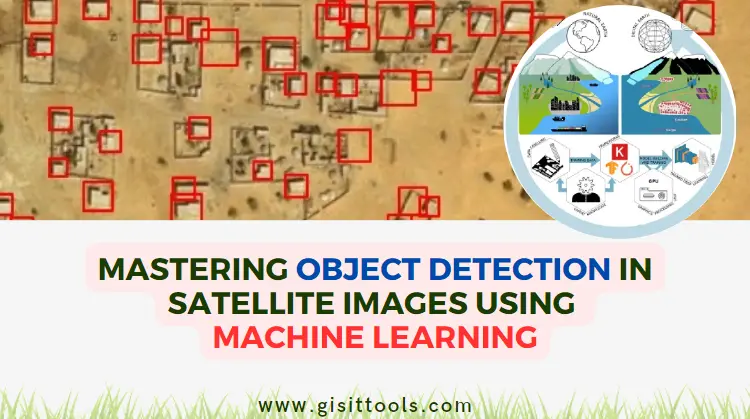
In today's rapidly evolving technological landscape, satellite imagery has become an indispensable tool for a wide range of applications, from environmental monitoring to urban planning and disaster management. One of the most exciting applications of satellite imagery is the use of machine learning techniques to detect and locate objects of interest within these images. This article delves into the fascinating world of object detection in satellite imagery through the lens of machine learning.
Understanding Object Detection in Satellite Imagery
Object detection is a complex computer vision task that plays a pivotal role in numerous industries by automating the process of identifying and localizing objects within images or video streams. This technology has far-reaching applications, from safeguarding national security and optimizing urban planning to improving agricultural practices and enhancing disaster response.
In satellite imagery, object detection is particularly transformative. The ability to automatically locate and classify objects within vast and detailed overhead images has revolutionized fields that rely on spatial data. Let's delve deeper into the significance of object detection in satellite imagery across various domains:
1. Agriculture: Satellite imagery is being harnessed to revolutionize agricultural practices. By employing object detection, farmers can accurately monitor crop health, identify pest infestations, and assess crop yields on a large scale. Detection of individual plants, trees, and even livestock within agricultural landscapes empowers precision agriculture, optimizing resource allocation and increasing productivity.
2. Environmental Monitoring: Detecting changes in landscapes over time is crucial for understanding environmental trends. Object detection can assist in tracking deforestation, land use changes, and habitat disruptions. This aids in conservation efforts, allowing researchers to identify areas of concern and take proactive measures to preserve ecosystems.
3. Disaster Management and Response: During natural disasters, such as hurricanes, earthquakes, or wildfires, rapid assessment of affected areas is vital for efficient response efforts. Object detection helps identify damaged infrastructure, collapsed buildings, and blocked roads, enabling authorities to prioritize rescue operations and allocate resources effectively.
4. Urban Planning and Infrastructure Management: Object detection facilitates urban planners in assessing infrastructure needs and identifying potential hazards. By locating objects like utility poles, road signs, and buildings, city planners can make informed decisions about zoning, transportation routes, and infrastructure improvements.
5. Military and Defense: The defense sector benefits from object detection in satellite imagery for various purposes. Identifying military installations, tracking the movement of vehicles, and monitoring potential threats in remote regions are all critical applications. This enhances situational awareness and aids in strategic decision-making.
6. Archaeology and Cultural Heritage: Satellite imagery coupled with object detection assists archaeologists in identifying potential archaeological sites and detecting changes in historical sites over time. This technology aids in preserving cultural heritage by enabling remote monitoring and assessment.
7. Natural Resource Management: Detecting objects like mining equipment, logging activities, and water bodies is invaluable for managing natural resources sustainably. Satellite-based object detection supports regulatory agencies in enforcing environmental regulations and preventing unauthorized resource extraction.
8. Infrastructure Inspection: Infrastructure such as bridges, dams, and pipelines require regular inspection to ensure safety and structural integrity. Object detection helps automate the process by identifying anomalies, cracks, and other potential issues, minimizing the need for manual inspections.
Challenges of Object Detection in Satellite Imagery
Varying Resolutions: Satellite imagery is captured by a diverse range of satellites with varying sensor resolutions. These resolutions can vary from meters to centimeters per pixel. This introduces challenges in object detection as smaller objects may be barely discernible in lower-resolution images, requiring the model to handle a wide range of scales. Machine learning models designed for object detection need to be capable of detecting objects at different sizes and levels of detail.
Changing Lighting Conditions: Satellite imagery is often captured under different lighting and weather conditions. Shadows, glare, cloud cover, and variations in sunlight angle can all affect the appearance of objects in the images. Traditional rule-based approaches struggle to adapt to these variations effectively. Machine learning models, on the other hand, can learn to recognize objects based on patterns in the data rather than relying on predefined rules, making them more robust to changes in lighting conditions.
Occlusions Caused by Natural Features: Natural features such as trees, buildings, and mountains can lead to occlusions, where objects of interest are partially hidden from view. These occlusions can confuse traditional detection methods that rely on simple geometric or color-based rules. Machine learning models excel at learning complex relationships and can infer the presence of objects even when they are partially obscured. This ability to learn from data enables them to identify objects based on contextual information and patterns.
Sheer Volume of Data: Satellite imagery produces vast amounts of data, often spanning large geographical areas and capturing numerous objects simultaneously. Manually processing and analyzing this data would be impractical and time-consuming. Machine learning techniques can process and analyze large datasets quickly, automating the detection process and enabling rapid decision-making. Additionally, machine learning models can leverage parallel processing and GPU acceleration to handle the computational demands of analyzing such large volumes of data.
Data Imbalance and Labeling Challenges: Collecting labeled data for training can be a significant challenge. In some cases, certain objects of interest might be rare in the dataset, leading to data imbalance. This can impact the model's ability to detect these rare objects accurately. Labeling satellite images for training also requires specialized expertise due to the complexity of the images and the need for precise annotations. Annotating objects at varying scales, orientations, and under different conditions can be labor-intensive.
Generalization to Different Locations: A machine learning model trained on satellite imagery from one location might not generalize well to other regions with different geographical and environmental characteristics. This is known as the domain shift problem. Transfer learning techniques can partially address this challenge by using a pre-trained model as a starting point and fine-tuning it on the specific dataset of interest. However, achieving strong generalization across diverse locations remains an ongoing research area.
Privacy and Ethical Concerns: Satellite imagery can capture sensitive information about individuals, buildings, and activities. There are ethical considerations surrounding the use of machine learning models for object detection in satellite imagery, particularly when it comes to privacy and data security. Striking a balance between the benefits of these technologies and respecting privacy rights is an essential aspect of their deployment.
Steps to Find Objects from Satellite Imagery Through Machine Learning
1. Data Collection and Preprocessing:
When embarking on an object detection project using satellite imagery and machine learning, the quality and diversity of the dataset play a pivotal role in the success of the model. Here's a deeper dive into the nuances of data collection and preprocessing:
Data Collection: Acquiring a diverse and representative dataset is essential. This dataset should encompass a wide range of scenarios, object types, and environmental conditions that the model might encounter in real-world situations. Collaborating with domain experts can provide valuable insights into which objects to focus on and what specific attributes to consider during annotation.
Annotation Types: Annotations are the labeled information that guides the machine learning model. They depict the location and extent of objects in the images. Annotations can take various forms:
- Bounding Boxes: These are rectangular regions drawn around objects of interest. They indicate where the object is located and its rough dimensions.
- Polygons: For irregularly shaped objects, such as bodies of water or agricultural fields, polygons are a more accurate annotation method. They outline the exact shape of the object.
- Semantic Masks: Semantic segmentation involves labeling each pixel in an image with the object class it belongs to. This level of annotation provides fine-grained object localization but requires more intensive labeling efforts.
Labeled Data Quality: The accuracy of annotations is critical. Annotation errors can lead to the model learning incorrect associations and ultimately hinder its performance. To maintain high-quality annotations, establish annotation guidelines, perform regular quality checks, and involve experts to resolve any ambiguities.
Data Preprocessing: Preparing the data for training involves several preprocessing steps:
- Resizing: Satellite images can have varying resolutions due to differences in sensor capabilities and altitudes. Resizing the images to a consistent resolution ensures uniformity during training and avoids any bias toward higher or lower resolutions.
- Normalization: Pixel values in satellite images can span a wide range. Normalizing these values to a standard scale (e.g., 0 to 1) helps the model converge faster during training and prevents the dominance of certain pixel ranges.
- Data Augmentation: Augmentation techniques artificially increase the dataset's diversity by applying transformations like rotation, flipping, cropping, and changes in lighting conditions. These augmentations simulate real-world variations and enhance the model's ability to generalize to different scenarios.
- Balancing Classes: In cases where certain object classes are significantly rarer than others, class imbalance can impact the model's performance. Techniques such as oversampling or adjusting loss weights can help mitigate this issue.
Data Privacy and Ethics: It's important to consider the ethical and privacy implications of the data you're using. Ensure that the data has been collected and used in compliance with relevant regulations and privacy concerns. Also, be mindful of potential biases in the dataset that could lead to skewed or unfair results.
2. Model Selection: Choosing the Right Architecture for Object Detection
Selecting the appropriate model architecture is a crucial decision when embarking on the journey of object detection in satellite imagery using machine learning. Convolutional Neural Networks (CNNs) form the foundation of modern object detection models due to their ability to capture intricate patterns and features within images. Here, we delve deeper into the popular object detection architectures – Faster R-CNN, YOLO, and SSD – highlighting their unique characteristics, advantages, and considerations for choosing one over the other.
Faster R-CNN (Region-CNN)
The Faster R-CNN architecture introduced a significant improvement in object detection by combining a Region Proposal Network (RPN) with a CNN-based object detector. It streamlines the detection process by generating region proposals that are then refined to accurately localize and classify objects within an image. This two-step approach enables Faster R-CNN to achieve high accuracy by focusing only on regions likely to contain objects.
Advantages:
- Accurate Localization: Faster R-CNN excels at precise object localization due to its two-stage nature.
- Versatility: It can detect objects of varying sizes and aspect ratios effectively.
- Advanced Features: The architecture supports multi-scale and multi-aspect ratio detection, which is beneficial for complex scenes.
Considerations:
- Complexity: Faster R-CNN's two-stage architecture can be computationally intensive, impacting processing speed.
- Resource Demands: Training and using Faster R-CNN may require more memory and computational power compared to other architectures.
YOLO (You Only Look Once)
The YOLO architecture revolutionized object detection by introducing a single-stage approach. YOLO divides the input image into a grid and predicts bounding boxes and class probabilities for objects within each grid cell. This real-time approach offers remarkable speed, making it a preferred choice for applications requiring rapid analysis.
Advantages:
- Speed: YOLO is known for its real-time processing capability, making it ideal for applications demanding quick responses.
- Simplicity: Its single-stage design simplifies the detection process compared to multi-stage architectures.
- End-to-End: YOLO directly predicts object attributes and locations in a single pass, eliminating the need for region proposals.
Considerations:
- Small Objects: YOLO can struggle with detecting small objects due to the grid-based nature of its predictions.
- Accuracy Trade-off: While fast, YOLO may sacrifice a bit of accuracy compared to two-stage architectures like Faster R-CNN.
SSD (Single Shot MultiBox Detector)
SSD combines the advantages of both Faster R-CNN and YOLO by detecting objects in a single pass while also incorporating multiple scales of feature maps. It achieves this by predicting bounding boxes and class probabilities across various feature layers with different resolutions.
Advantages:
- Balance Between Speed and Accuracy: SSD offers a good balance between real-time performance and detection accuracy.
- Multi-Scale Detection: It excels at detecting objects of different sizes and scales within an image.
- Resource Efficiency: SSD's architecture is well-suited for scenarios where computational resources are limited.
Considerations:
- Limited Precision: While accurate, SSD may not achieve the same level of localization precision as Faster R-CNN for small objects.
- Scale Sensitivity: The selection of anchor box sizes and aspect ratios can impact its performance on different scales of objects.
Choosing the Right Architecture for Your Needs
The choice of object detection architecture depends on your specific use case, priorities, and available resources. If accuracy and precise localization are paramount, Faster R-CNN might be the way to go. For applications demanding real-time processing and speed, YOLO could be the better fit. SSD, on the other hand, offers a balanced compromise between accuracy and speed, making it suitable for a wide range of applications.
3. Model Training: Understanding the Core Process
Model training is the pivotal phase where machine learning algorithms are taught to recognize objects within satellite imagery. This process involves training a neural network to detect patterns and features that define the objects of interest. Let's delve deeper into the intricacies of model training and the techniques involved in achieving accurate object detection.
Data Preparation: Before training begins, your labeled dataset needs careful attention. A balanced dataset that represents the real-world distribution of objects is vital for training a robust model. Data augmentation techniques like rotation, scaling, and flipping can be applied to artificially increase the dataset size and diversify the training samples, making the model more resistant to variations in lighting and perspective.
Loss Functions: During training, the neural network aims to minimize a loss function that quantifies the discrepancy between its predictions and the ground truth annotations. Common loss functions for object detection include the Smooth L1 loss and the focal loss. These loss functions weigh errors differently depending on the predicted confidence scores and the level of precision required.
Optimization Algorithms: Optimization algorithms play a crucial role in updating the neural network's parameters to minimize the chosen loss function. Backpropagation, a technique that calculates gradients of the loss with respect to each parameter, enables the network to adjust its internal weights and biases. Algorithms like Stochastic Gradient Descent (SGD) and its variants (e.g., Adam, RMSprop) facilitate this optimization process, steering the model toward better accuracy.
Anchor Boxes and Bounding Box Regression: In object detection, anchor boxes are predefined boxes of different sizes and aspect ratios that are used to localize objects. The model learns to predict adjustments to these anchor boxes to precisely fit the bounding boxes around detected objects. This process, called bounding box regression, helps the model accurately delineate object boundaries.
Feature Pyramid Networks: Objects can appear at different scales within an image. Feature Pyramid Networks (FPN) enhance the model's ability to detect objects of varying sizes. FPN creates a multi-scale feature map by combining features from different layers of the neural network. This enables the model to detect both small and large objects in the same image.
Training Challenges: Computational Resources and Overfitting: Training object detection models demands substantial computational resources. The deep neural networks used for this task require powerful GPUs or TPUs to efficiently process the large number of parameters and data points involved. Additionally, overfitting, a phenomenon where the model performs exceptionally well on the training data but poorly on new data, is a concern. Techniques like dropout and regularization can mitigate overfitting by preventing the model from relying too heavily on individual training examples.
Validation and Hyperparameter Tuning: To avoid overfitting and ensure generalization, a portion of the labeled dataset is set aside for validation. This validation dataset helps to monitor the model's performance on unseen data during training. Hyperparameters, such as learning rate, batch size, and the number of training epochs, influence the training process and need to be tuned to achieve optimal results. This tuning process often involves trial and error, as well as leveraging techniques like learning rate schedules.
Transfer Learning and Pretrained Models: Training an object detection model from scratch requires substantial computational resources. Transfer learning offers a more efficient approach by leveraging pre-trained models on large benchmark datasets like ImageNet. By fine-tuning these pre-trained models on satellite imagery, you can take advantage of their learned features, enabling faster convergence and improved performance.
4. Post-processing: Refining Object Detection Output
After the object detection model has been trained on satellite imagery, the process doesn't end there. The raw output of the model may still require refinement to ensure accurate and reliable object detection results. This step, known as post-processing, involves several techniques that help enhance the quality of detections and streamline the final output.
a) Non-maximum Suppression (NMS): One common issue in object detection is the presence of duplicate detections for the same object. Non-maximum suppression is a technique used to address this problem. It involves sorting the detections based on their confidence scores and then iteratively suppressing detections with significant overlap. Only the detection with the highest confidence in each group of overlapping detections is retained, reducing redundancy and ensuring that each object is represented only once.
b) Confidence Thresholding: To control false positives, a confidence threshold can be applied to the detected objects. The confidence score assigned by the model represents how certain it is about the presence of an object in a specific bounding box. By setting a threshold, you can filter out detections with confidence scores below that value. This helps eliminate spurious or less reliable detections, ensuring that only detections with a certain level of confidence are considered.
c) Bounding Box Refinement: While modern object detection models are quite accurate, the bounding boxes they produce might not be perfectly aligned with the objects they are detecting. Bounding box refinement involves adjusting the coordinates of the detected bounding boxes to more accurately fit the shape and extent of the actual object. Techniques like regression can be used to fine-tune the coordinates of the bounding boxes based on the model's output and the ground truth annotations.
d) Aspect Ratio and Size Constraints: In some cases, you might want to filter out detections based on their aspect ratio or size. For instance, if you're detecting vehicles in satellite images, you might want to discard detections that are too small to be vehicles or have unusual aspect ratios that don't match typical vehicle shapes. Applying constraints on aspect ratios and sizes can help eliminate unlikely or irrelevant detections.
e) Spatial Consistency: Objects in satellite imagery are often constrained by real-world geometry and relationships. For example, buildings tend to be vertically aligned, and roads typically follow specific patterns. Leveraging this spatial consistency can improve the accuracy of object detection. By considering the relative positions and orientations of detected objects, you can refine the detections further.
f) Semantic Filtering: In certain applications, you might be interested in detecting specific types of objects, such as buildings or vehicles. Semantic filtering involves using additional information or context to validate the detected objects. This could involve using segmentation masks, classifying objects based on their appearance, or incorporating contextual data from other sources.
5. Evaluation and Fine-tuning: Ensuring Model Accuracy and Robustness
After training your object detection model, the next critical step is to evaluate its performance and fine-tune it for optimal results. This phase is pivotal in ensuring that the model not only identifies objects accurately but also maintains robustness across different scenarios and conditions.
Evaluation Metrics: Precision, Recall, and F1-Score
When assessing the effectiveness of your object detection model, a set of evaluation metrics is used to provide a comprehensive understanding of its performance. These metrics help you strike a balance between correctly identifying objects and minimizing false positives.
- Precision: Precision is the ratio of true positive predictions to the total number of positive predictions made by the model. It measures how many of the detected objects are actually relevant. A high precision value indicates that when the model makes a prediction, it is more likely to be correct.
Precision=True Positives / False Positives + True Positives
- Recall (Sensitivity): Recall is the ratio of true positive predictions to the total number of actual positive instances in the dataset. It measures the model's ability to identify all relevant instances. High recall indicates that the model is effectively capturing a larger portion of the actual objects.
Recall=True Positives / False Negatives + True Positives
- F1-Score: The F1-score is the harmonic mean of precision and recall. It provides a balanced assessment of the model's accuracy. F1-score becomes especially useful when there's an uneven class distribution or when both precision and recall are equally important.
F1−Score = 2×Precision×Recall / Precision+ Recall
Threshold Selection: Finding the Right Balance
Object detection models often assign confidence scores to their predictions. These scores indicate the model's certainty about its predictions. By adjusting the confidence threshold, you can control the trade-off between precision and recall. A higher threshold increases precision but might lead to missed detections, while a lower threshold can increase recall but might introduce more false positives.
Fine-tuning Strategies
Based on the evaluation results, fine-tuning the model becomes crucial to enhance its accuracy and robustness. Here are some strategies for effective fine-tuning:
- Hyperparameter Tuning: Experiment with different hyperparameters, such as learning rates, batch sizes, and optimization algorithms, to find the best configuration for your specific dataset and model architecture.
- Data Augmentation: Expand your training dataset by applying various data augmentation techniques, such as rotation, scaling, and flipping. This helps the model generalize better to different orientations and viewpoints.
- Transfer Learning: Utilize pre-trained models that have been trained on large-scale datasets. Fine-tune these models on your specific dataset to take advantage of their learned features while adapting them to your target objects.
- Ensemble Methods: Combine the predictions of multiple models to improve overall accuracy and reduce the risk of individual model biases.
- Error Analysis: Thoroughly analyze the false positive and false negative cases to identify patterns and common errors made by the model. This analysis can guide you in making targeted improvements.
6. Deployment and Integration: Leveraging Object Detection Insights
Deploying an object detection model for satellite imagery is a crucial phase that bridges the gap between the trained model and its real-world application. This phase involves not only making the model accessible for image analysis but also ensuring its seamless integration into existing systems, enabling efficient decision-making processes. Here's a deeper look at this phase:
Deployment Strategies:
- Cloud-based Deployment: Hosting your object detection model on cloud platforms like AWS, Google Cloud, or Azure offers scalability and accessibility. Cloud services provide the necessary computational power to handle large-scale image processing while allowing easy access from various locations.
- Edge Deployment: Deploying the model on edge devices, such as drones or local servers, brings the processing closer to the data source. This reduces latency and is suitable for applications requiring real-time or near-real-time analysis, such as disaster response and surveillance.
Integration with Existing Systems:
- API Integration: Many modern object detection frameworks provide APIs (Application Programming Interfaces) that allow seamless integration with other software applications. By incorporating the model's API into your existing software, you can automate the process of sending satellite images for analysis and receiving the detection results.
- GIS Integration: Geographic Information Systems (GIS) play a pivotal role in managing spatial data. Integrating your object detection model with a GIS platform enables you to visualize the detected objects on maps, extract valuable spatial insights, and make location-based decisions.
Real-time vs. Batch Processing:
- Real-time Processing: Certain applications require immediate insights from satellite imagery, such as detecting anomalies during disaster events or tracking rapidly changing phenomena. Real-time processing demands low latency and high computational power, often achieved through edge deployment.
- Batch Processing: In scenarios where immediate results are not necessary, batch processing can be employed. This involves analyzing a collection of satellite images at once, allowing for efficient utilization of computational resources. Batch processing is particularly useful for tasks like trend analysis and long-term monitoring.
Monitoring and Maintenance:
- Performance Monitoring: Even after deployment, ongoing monitoring of the model's performance is crucial. Tracking metrics like detection accuracy, false positives, and false negatives helps identify potential issues and prompts timely adjustments.
- Model Updates: Satellite imagery can vary due to changing weather conditions, seasons, and other factors. Regularly updating the model using new and relevant data ensures that it remains effective over time.
Security and Privacy Considerations:
- Data Privacy: Satellite imagery might contain sensitive information, such as private property or military installations. Implement measures to protect sensitive data during the deployment and analysis processes.
- Secure Communication: Ensure that data transmission between the deployed model and other systems is secure to prevent unauthorized access or data breaches.
Use Cases and Benefits:
- Environmental Monitoring: Deployed object detection models can help monitor deforestation, track wildlife movements, and identify changes in land cover over time, aiding conservation efforts.
- Urban Planning: Integration with urban planning systems can assist in identifying areas of rapid urbanization, tracking infrastructure development, and predicting urban growth patterns.
- Disaster Management: Real-time deployment of models can provide critical insights during natural disasters, such as identifying affected areas and locating survivors.
7. Continuous Improvement: Adapting Object Detection Models Over Time
The development of an effective object detection model doesn't end with its initial deployment. In fact, the true power of machine learning shines when models are continuously refined and adapted to evolving conditions. The concept of continuous improvement is particularly crucial in the context of satellite imagery object detection, where the environment, data quality, and object characteristics can change over time. Here's a closer look at how the process of continuous improvement unfolds:
Data Collection and Integration: As new satellite imagery is collected, it's essential to incorporate this fresh data into the existing dataset. This might involve manually annotating the new images or using semi-automated techniques to label objects. By updating the dataset with new examples, the model becomes exposed to the most current object variations, lighting conditions, and contexts.
Retraining the Model: The availability of new data serves as an opportunity to retrain the object detection model. Retraining involves using the combined existing and new data to fine-tune the model's parameters. This process enables the model to better capture any changes in the appearance of objects, detect new object categories, and adapt to shifts in background and lighting.
Transfer Learning: In some cases, the amount of new data might be limited. Transfer learning comes into play here, allowing you to take advantage of the knowledge the model has gained from the original dataset. By fine-tuning the model with the new data while preserving its knowledge from the previous training, you can achieve improved performance with fewer new examples.
Adjusting Model Hyperparameters: Hyperparameters are settings that dictate how the model learns from data. They include parameters like learning rate, batch size, and architecture-specific settings. Continuous improvement involves fine-tuning these hyperparameters based on the characteristics of the new data and the model's current performance. This process requires a balance between exploration (trying new values) and exploitation (leveraging what has worked well previously).
Monitoring Performance: During continuous improvement, it's crucial to closely monitor the model's performance on both new and existing data. Tracking metrics such as Precision, Recall, F1-score, and accuracy helps you gauge how well the model is adapting to changes. Identify any degradation in performance and investigate whether it's due to new data challenges or other factors.
Regular Reevaluation of Annotations: As you accumulate new data, it's wise to periodically review and update the annotations provided for the objects in the images. Over time, object definitions might change or evolve, and annotations might become outdated or imprecise. By ensuring that the annotations accurately reflect the ground truth, you maintain the quality of your training data.
Feedback Loop and Collaboration: Engage with domain experts, stakeholders, and end-users who interact with the model's output. Their insights and feedback can reveal whether the model's detections align with real-world observations. This iterative feedback loop helps in identifying areas for improvement that might not be immediately apparent from quantitative metrics alone.
Conclusion
The marriage of machine learning and satellite imagery has unlocked a world of possibilities for object detection and localization. By following the steps outlined in this article – from data collection and preprocessing to model training and deployment – you can harness the power of artificial intelligence to make accurate and impactful observations from above. As technology advances and datasets grow, the potential for object detection in satellite imagery is bound to expand, reshaping industries and revolutionizing the way we perceive and interact with our world.
comments
Leave a Reply
Your email address will not be published. Required fields are marked *